Ipswich is a historic county town in Suffolk, England. The town is located in East Anglia about 10 miles (16 km) away from the mouth of the River Orwell and the North Sea.
Ipswich is both on the Great Eastern Main Line railway and the A12 road, it is 66 miles (106 km) north-east of London, 54 miles (89 km) east-southeast of Cambridge, and 45 miles (72 km) south of Norwich. It is surrounded by two Areas of Outstanding Natural Beauty (AONB); Suffolk Coast and Heaths and Dedham Vale.
Ipswich was a settlement of great economic importance to England throughout its history, particularly in trade. The town’s historical dock, present-day Ipswich Waterfront, was known as the largest and most important dock in the kingdom.
Ipswich has become a tourist hotspot in the UK, it was voted as the 7th most desirable place to live and work in England by the Royal Mail in 2017. In 2007, Ipswich was awarded the cleanest town award, and in 2015, it was rated as the third happiest place to live in the UK.
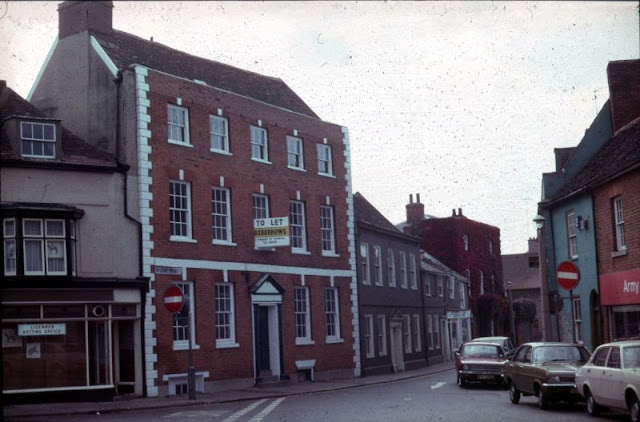
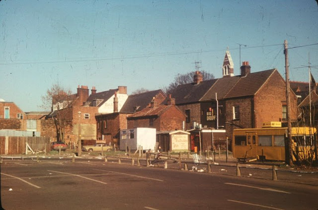
Take a look at these amazing color photos from The Ipswich Society Image Archive to see what Ipswich looked like in the 1970s.
![]() |
| Dogs Head St looking westwards from Tacket St |
![]() |
| Alderman Road looking east |
![]() |
| A panoramic view westwards along Carr St towards Tavern St taken from the top of the Eastgate Development |
![]() |
| Alderman Road Recreation Ground |
![]() |
| Buttermarket opposite St Lawrence Lane |
![]() |
| Cemetery Road from Christchurch Street |
![]() |
| Christchurch Street |
![]() |
| Coytes Gardens is off the east side of Princes St and lead to Friars St via a right angled corner |
![]() |
| Felixstowe Road |
![]() |
| Foundation St looking south with Cranfields in the distance |
![]() |
| Friars Road and Friars St junction |
![]() |
| Lloyds Avenue Arch |
![]() |
| Looking east at The Ancient House with ABC Ritz Cinema |
![]() |
| Looking east towards St Helens Street with Botwoods garage on the left |
![]() |
| Looking eastwards along Spring Road towards the Spring Road Viaduct on the Westerfield to Felixstowe railway line |
![]() |
| Looking north over Stoke Bridge whilst the former yeast works were being demolished |
![]() |
| Looking north to The Civic Centre from Gt Gipping St over the back gardens in Little Gipping St |
![]() |
| Looking north towards Tacket St at the west side of Foundation St |
![]() |
| Looking south along the east side of Upper Brook St with the junction with Tacket St in the distance |
![]() |
| Museum Street |
![]() |
| Queen St / Princes St |
![]() |
| Silent St looking south towards St Nicholas St at the row of half timbered buildings on the north side |
![]() |
| Silent St viewed from Falcon St |
![]() |
| Silent St |
![]() |
| South side of St Matthews Street after dual carriageway development |
![]() |
| Star Lane, part of the College St traffic gyratory scheme |
![]() |
| The Cornhill |
![]() |
| The glass cladding of the Willis Faber building is in progress |
![]() |
| The north side of Old Foundry Road |
![]() |
| The north side of Tacket St before demolition of this row of properties for road widening |
![]() |
| The west side of St Nicholas St looking north from Franciscan Way (left) to Friars St. with the top of the Town Hall in right background |
![]() |
| Upper Brook St and Dogs Head St |
![]() |
| Upper Orwell Street |
![]() |
| View looking north west from the Belstead Road embankment, Ipswich Station in the foreground |
![]() |
| Westward view from roof of Ipswich School showing the back gardens and rear of houses in Warrington Road |


